
PRINCE GEORGE, by Shane Chevalier
Tuesday, January 30, 2024 at 9:04 am. Updated at 2:00 pm January 30, 2024
UPDATE – Crews have made good progress on Tuesday morning to restore power to more than 3,000 customers in the Prince George area after a powerful windstorm hit the Central Interior overnight. Crews are responding as fast as they can to restore power to the remaining customers. Please continue to check the outage list for up-to-date information including estimated restoration times. BC Hydro thanks you for your patience as they work to restore power.
— Original story…
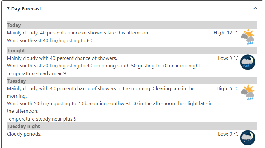
The wind was in the forecast for the overnight hours Tuesday for wind gusts up to 70 km/h, although the timing may have been a bit off, as a storm system made its way to the Prince George region between 1 am and 3 am, Tuesday. Radar at 2 am indicated a pattern change that brought in strong wind gusts and rain to the region. The temperature also increased to around 12 degrees at 2 am, that continued to melt all the snow Prince George received a week ago.
At YXS, the airport wind gauge clocked an 81.5 km wind gust during the event. The strong wind gusts knocked down trees onto many power lines in the region, with the rural areas being hit the hardest. Power is coming back to many city residents but the rural areas will take the longest to get restored.
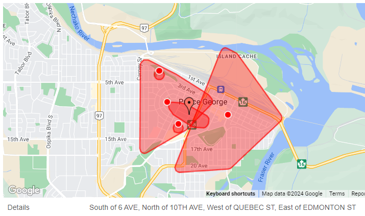
There are dozens of power outages in Prince George, Mackenzie, Chetwynd, Dawson Creek and up to Fort St. John at this hour. To view the list, because it is too long to post here, click here for those details!
The warm temperatures will stick around until at least Saturday.
Just to note, the Prince George Airport DID NOT break the extreme temperature record on Monday. The extreme temperature to beat was 12.2 degrees set back in 1931 and in 1940! We came close, and sat at 11.0 degrees. However, Monday’s high broke a “mean” temperature, or average temperature, set back in 1998 at 8.4 degrees. There is a difference!
