
PRINCE GEORGE
Friday, July 21, 2023 | 6:10 am
More thunderstorms are in the forecast for Friday. Environment Canada says 2,500 lightning strikes were in the PG region alone last night.
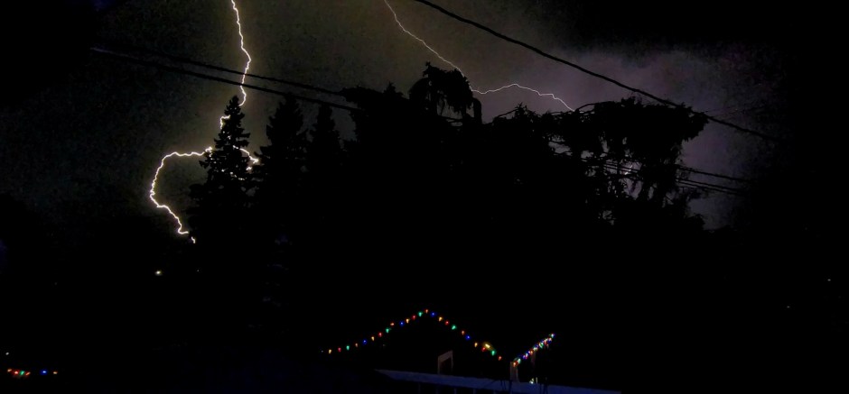
If you were awakened by thunder bombs last night you definitely were not alone after several storm cells rolled through the city late last night. PJXM has several videos of the storm systems that brought intense lightning and thunder.
Just before 9:30 pm, PJXM was alerted by lightning detection maps that several thunderstorms had popped up on radar and were moving at a good pace.
The first set of thunderstorms began just south of Highway 16 West at around 9:20 pm and were moving towards Isle Pierre with intense lightning, strong wind gusts and rain. The storm had moved out of the area just before 10 pm with it lingering in the background for a good hour.


Then at around 11:30 pm, PJXM was again alerted by lightning detection maps that 4 thunder cells had formed south of Prince George and were moving at a slow to medium pace straight for Prince George.
The temperature at this time of night was still around 21 degrees, warm enough to create some decent convection in the air.
Around 12 am, two of the thunder cells had joined forces right over top of Prince George, with intense lightning and thunder bombs. A thunder bomb is when lightning and thunder are instantaneous together at the same time, creating an intense bomb like sound. This storm lasted a good hour over top of Prince George knocking out power to around 132 people around the central part of the city. Surprisingly the storms did not knock power out to more than that.
Around 1 am, the storms were still kicking to the north and northeast of the city, around Salmon Valley and up towards Highway 16 East, as by this time the storms had split up, according to radar. Intense lightning and rain continued on until at least 2 am.
The thunderstorm risk for Friday is much the same. Cooler temperatures, as PJXM told you earlier this week, are moving in for the weekend and into next week.
